When looking for a multi-day hike in Jasper there are so many different choices and they all book up pretty quickly. Tonquin Valley was actually the backup plan for my backup plan. Before coming across the trail on the Parks Canada booking page I had never heard of it. While it is often overshadowed by the nearby Skyline Trial, this lesser known hike certainly doesn’t disappoint and I highly recommend it, however timing is everything!!
Within the first few kilometers of this hike I understood why there were so many open campsites to book during the month of July. Due to winter snow melt and spring rainfall the vast grassy meadows which make up the Tonquin Valley become more like a swamp in the early summer months. Not only does that mean you will be wading through ankle deep mud/water, but it also provides the ideal ecosystem for every hikers best friend, mosquitoes! There were hundreds of them swarming you any given moment (I wish this was an exaggeration). I honestly was ready to pack up and hike out after the first day but I’m so glad we didn’t. Long story short…DO NOT do this hike in July if you value your sanity!! Save it for mid/late August or September.
Moving on from the mosquitoes…
Tonquin Valley is a relocation hike, so there are two different trailheads about a 20 minute drive apart (both are off of highway 93A). The Astoria trailhead starts just before Cavell Lake, on the way up to Mount Edith Cavell, while the Portal Creek trailhead starts off of Marmot Road (both entry/exit points have parking lots next to them).
Like with any relocation hike, the ideal situation is to have multiple cars so that you can leave one at each trailhead. That’s not to say it’s impossible to do this hike with only one car, you’ll just need to get creative. Some hikers will enlist the aid of a taxi to shuttle them between trailheads, however from what I have heard they charge a flat rate of $100+ — certainly a pricey ride. On the other hand if you’re willing to take the risk, it is possible to hitch hike between the two trailheads. With fingers crossed (and a cab company number on deck) we opted for this riskier option and lucked out! We meet an awesome family on the first night who had the same itinerary as us and offered a ride back to our car on the final day.
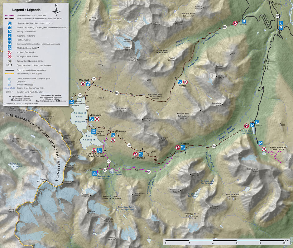
There are a couple big decision to make when planning your hike through the Tonquin Valley. The biggest one is choosing your starting point. Like previously mentioned there are two trailheads which you can choose to start from: Portal Creek or Astoria. The elevation profiles are fairly similar regardless of the direction. I did find that the stretch from Amethyst Lakes to Portal Creek was the more scenic half of the trail and so personally I’m glad we chose to save the best for last. The trail is also about 45km in length so it is definitely best done as a mulit-day trip. There quite a few campsites to choose from along the way and so you can really customize your stay. While there are clearly so may different ways to experience the Tonquin Valley, I’m going to share my personal 4 day itinerary.
Campsites in order of distance from Astoria trailhead: Astoria (7km), Switchback (14km), Clitheroe (17km), Surprise Point (19.5km or 17km via alt route), Amethyst (20.5km), Maccarib (24km), Portal (34.5km).
Day 1: Astoria Trailhead to Surprise Point
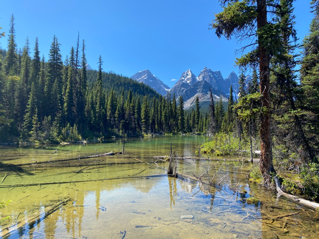
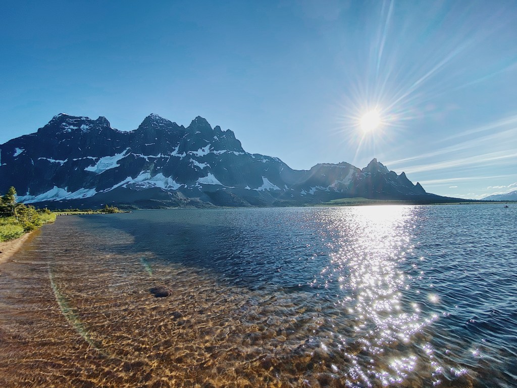
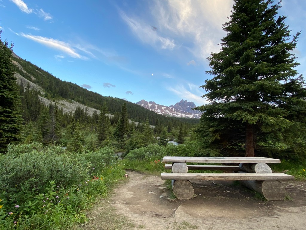
I decided to spend 4 days/3 nights completing the Tonquin Valley trail. On the first day we hiked 17km from Astoria trailhead to the Surprise Point campsite. I chose to camp at Surprise Point as it sits at the base of the Ramparts Mountain Range (hello views!) and it is also close to the Eremite Valley which I had hoped to explore the next morning.
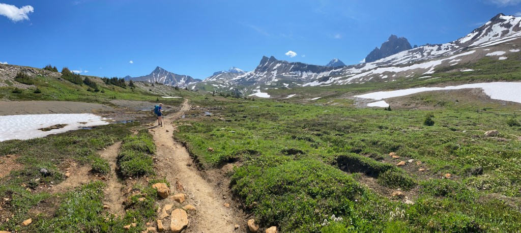
The first 7km from the trailhead to Astoria campground is relatively. It is not until you pass Astoria that the elevation begins to pick up. Not long after this point, you reach the first sign post where the trail splits in two directions. From here there are two different options: You can either continue right along the main trail towards Switchback and Clitheroe campsites, or cross a bridge on your left towards the ACC hut, Chrome lake and Surprise campsite. The main trail will also loop around to Surprise point but will add a couple of extra kilometers.
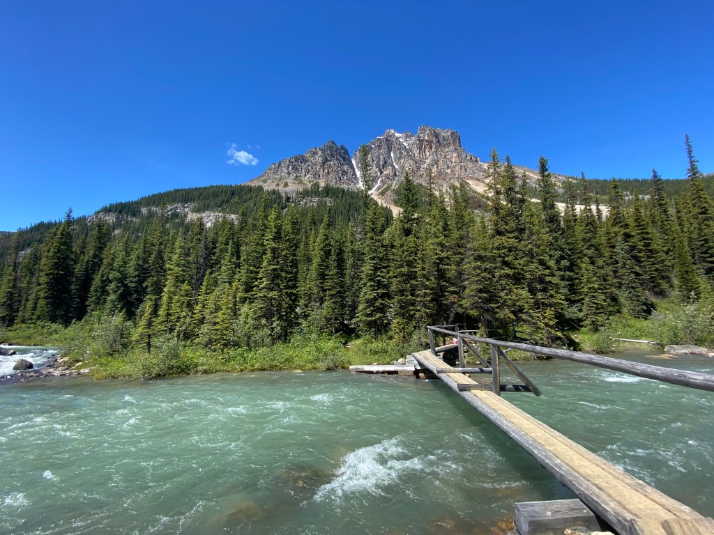
We had decided ahead of time to follow the ACC hut route alongside the Astoria River. I cannot vouch for how the trail was to Switchback and Clitheroe, but the ACC trail was rough! The 9km stretch was full of mud, creek crossings and bushwhacking. Like I did mention before hand, a lot of this was due to the time of year, however I would definitely advise people to stick to the main trail. That being said it was unique experience to say the least. After what felt like the longest hike of my life we emerged from the swampy trail to Chrome Lake. While the lake was lovely, it was heavily guarded by mosquitoes, so we did not stay long. From Chrome Lake it is roughly 2 more kilometers to Surprise Point.
As soon as we arrived at the campsite and stopped moving the bugs came out in full force. We scrambled to set up our tent, and jumped in as fast as possible. At this point I was in pretty low spirits. This first section of the hike was not overly exciting and on top of that leaving your tent meant being eaten alive. On this first afternoon/evening we really only emerged from the tent to eat and use the bathroom. To add insult to injury, the outhouses on this trail aren’t enclosed in a shelter and so you have to brave the swarms while trying to do your business.
Day 2: Surprise Point to Amethyst Lake
After a good nights sleep, and a very quick breakfast we packed up camp in record time. The original plan was to head south of Surprise Point into the Eremite Valley and spend the morning exploring, before going north to Amethyst Lake (about 5km from Surprise Point). However, after the trauma of the previous day I had no desire to spend anymore time hiking through swampland than I had to. Thus we went on our way towards Amethyst.
The trek between these two campsites is pretty quick and minimal in elevation change but the poor trail conditions made it a slow journey…surprise more mud and mosquitoes!! I swear I usually don’t let things like this bother me that much but when I tell you I have never seen anything like this I mean it!
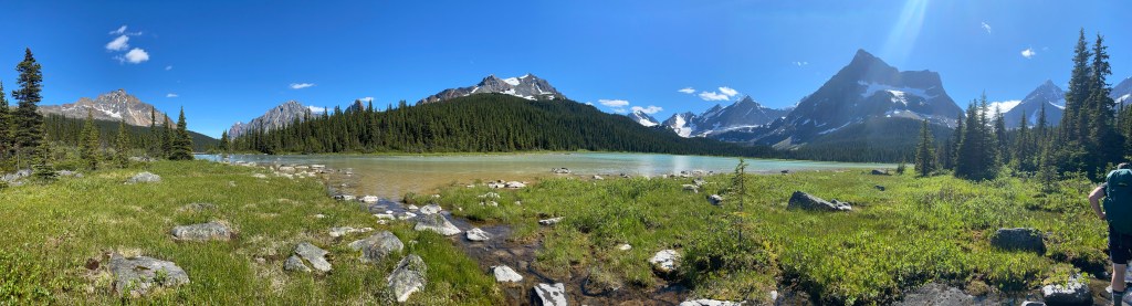
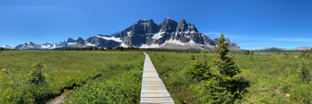
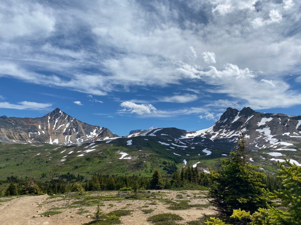
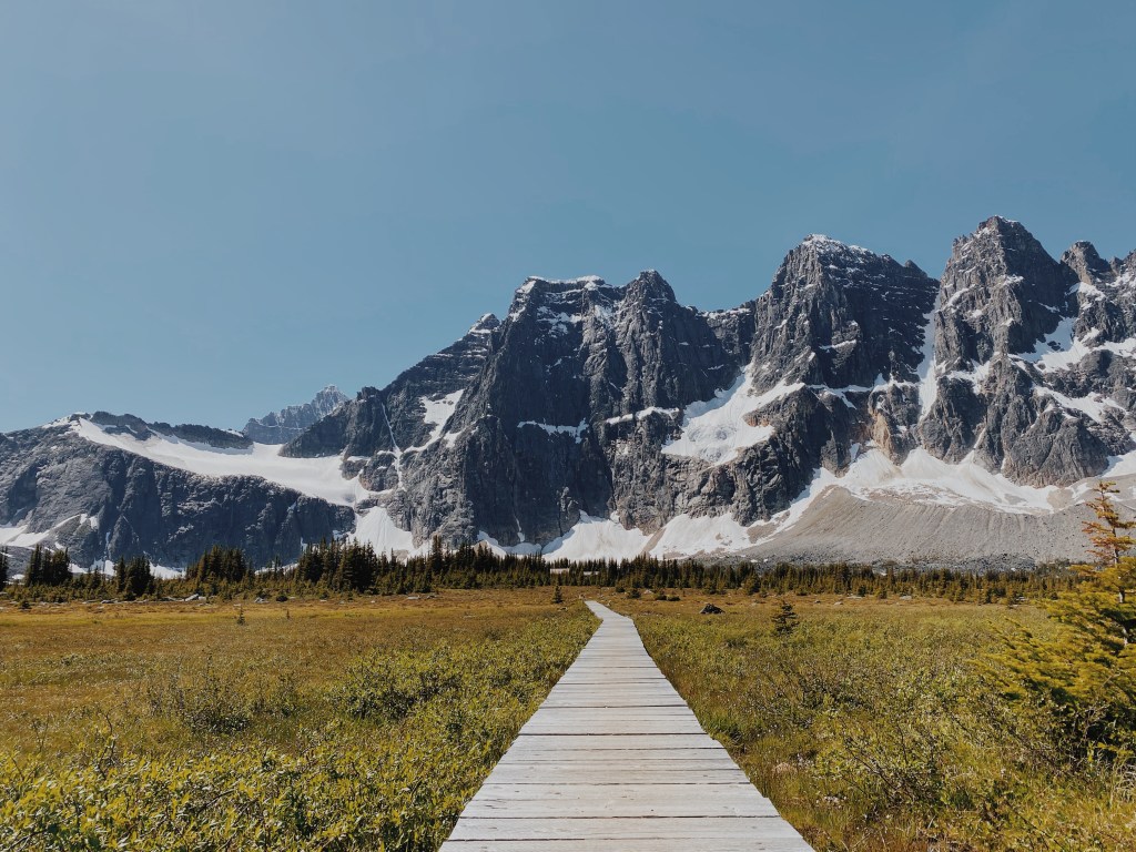
Once you get about 1km away from Amethyst Lake the poor trail transforms into a long stretch of boardwalk, offering up a full view of the Ramparts. Not only is the view heavenly, but there was a light breeze wisping through the meadow, warding off every single mosquito. Needless to say we decided this would be a fantastic place to stop for a while to relax and enjoy some snacks. Unsure of what circumstances lay ahead of us at the next campsite we were in no hurry to leave — I not so jokingly suggested setting up camp right then and there. After a blissful 45 minutes or so we continued the rest of the way to Amethyst Lake.
The campsite at Amethyst is about 400m from the lakeshore and so after setting up camp we grabbed a few drinks and headed down for a swim. As far as lakes in the rockies are concerned it wasn’t too cold and the breeze kept most of the bugs away, so we spent quite a bit of time down there. One of my highlights of the trip is eating dinner by the lake while the sun slowly set under the Ramparts.
Day 3: Amethyst Lake to Portal Creek
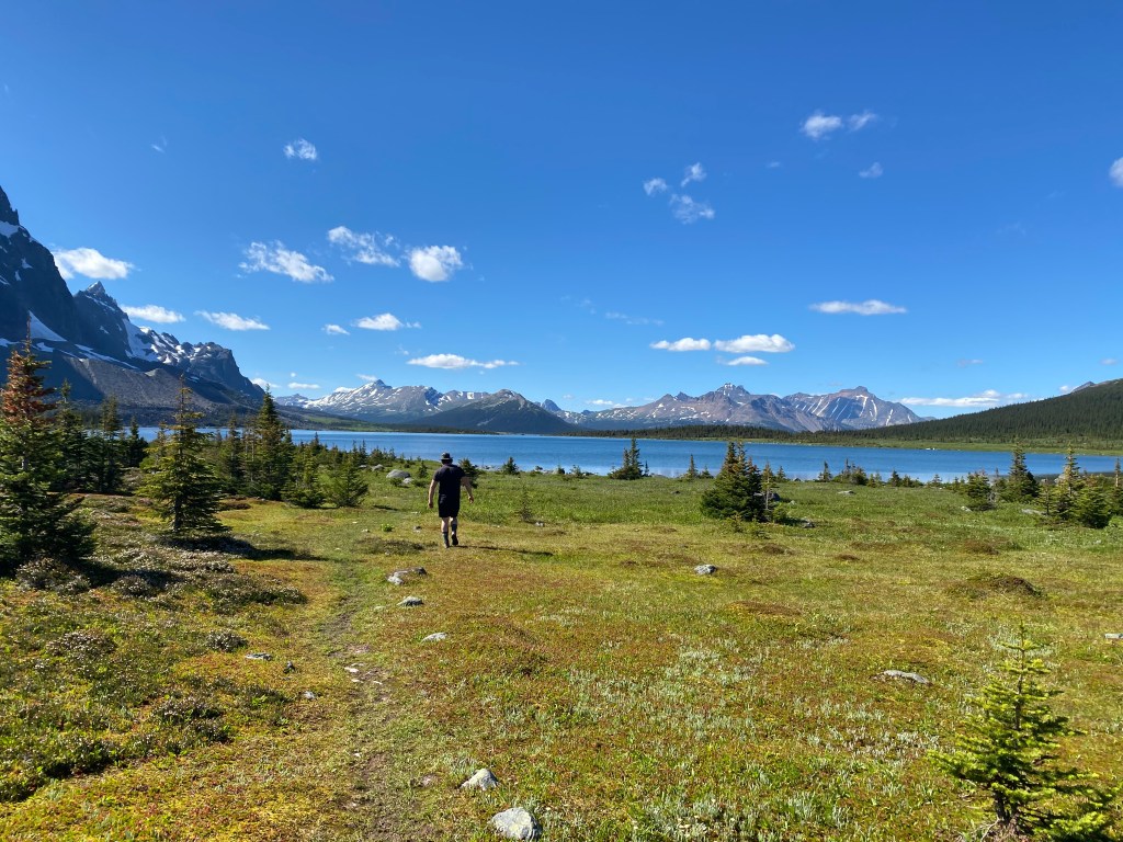
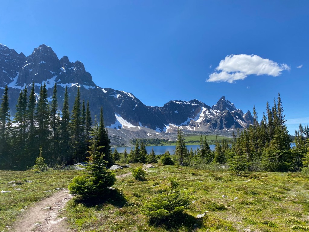
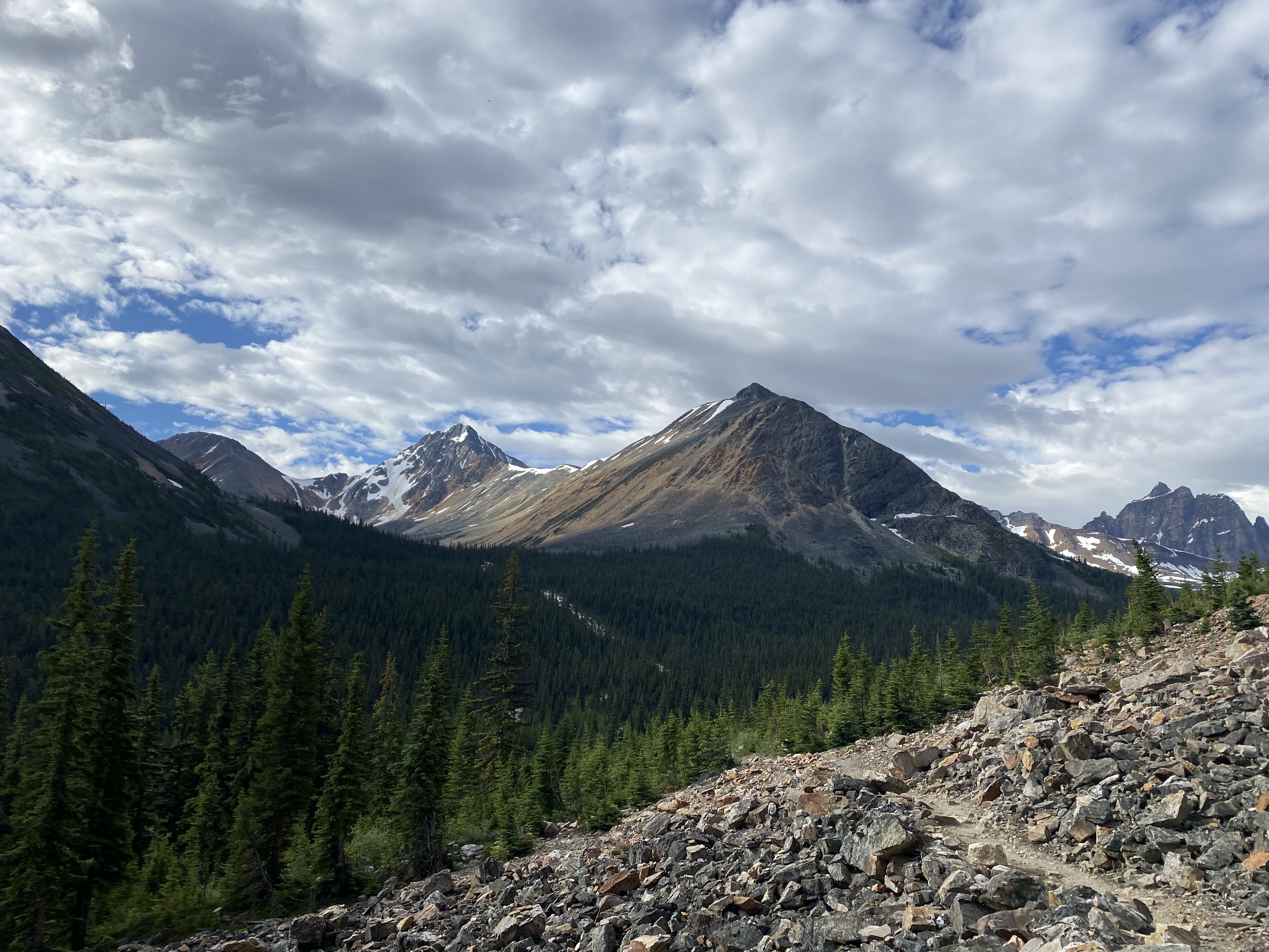
The destination for our final night was Portal Creek campground, about 14km from Amethyst Lake. This is hands down the best section of trail. Not only was it in much better condition, but it winds its way through an open valley surrounded by towering mountains and lush forest in the distance. It also helped that the mosquitoes seemed to get progressively better as we made our way further from the lake.
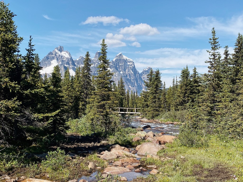
The first half of this section is pretty flat, as you follow along a narrow dirt path (with the occasional mud puddle) and over multiple bridged creek crossings. We moved slow and steady in the heat and probably stopped every 30 seconds to take pictures..
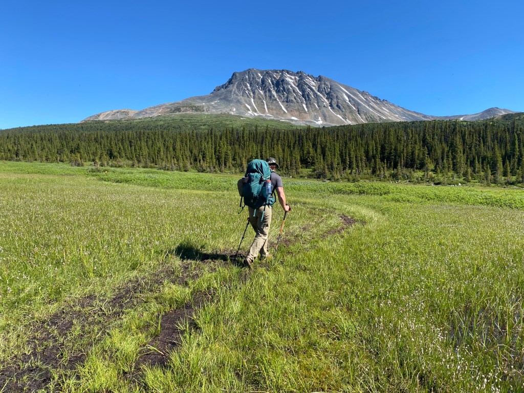
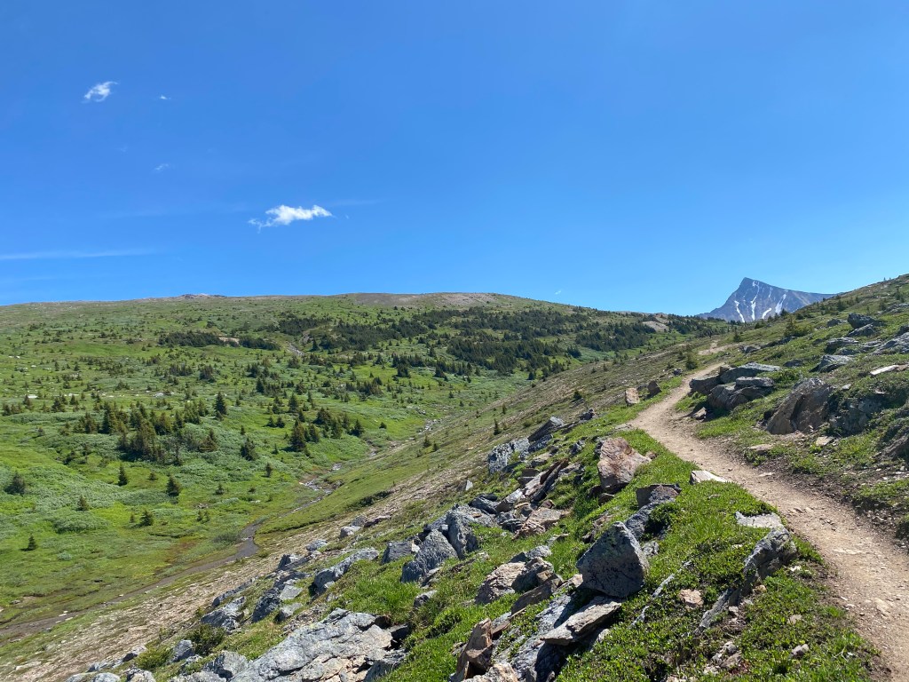
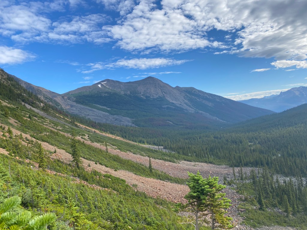
Eventually the elevation starts to pick up as you approach Maccarib Pass, which brings you up close and personal with Mount Maccarib and its surrounding peaks. At the top of the pass lays the perfect place to stop for lunch and soak everything in. We probably spent almost an hour just sitting here and relaxing in the sun.
After a long break and some food we descended down the latter half of Maccarib Pass towards Portal Creek. It’s only about 45 more minutes from here to the campsite. Nestled alongside Portal Creek (hence the name) this campsite was the perfect place to end a long, hot day. We pitched our tent and jumped straight into the creek! Day 3 was hands down my favourite day of the trip.
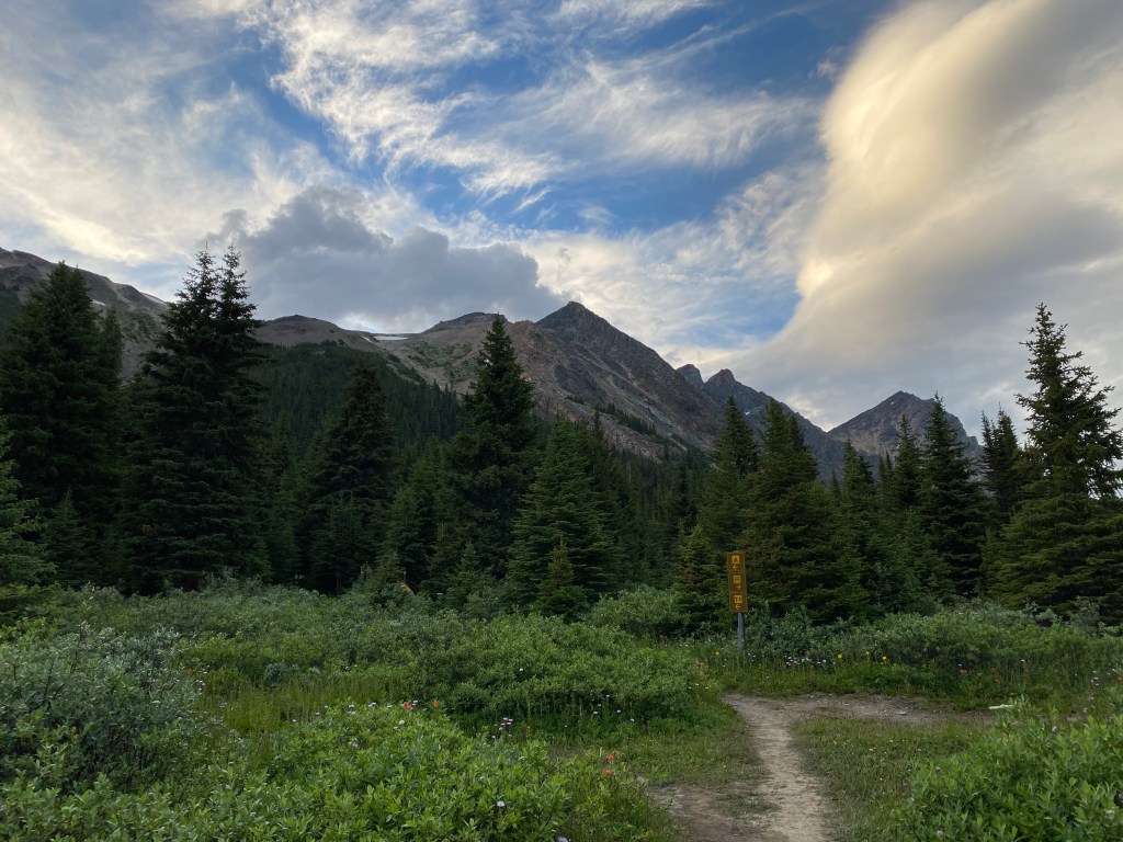
The Portal Creek campsite is fairly small, with only four tent pads. There ended up being two other groups staying there with us and thanks to a citronella ring left behind by previous campers, we were all finally able to sit outside our tents without fear. I was so thankful, one the best parts of hiking/backpacking trips is being able to meet new people — which is pretty hard to do when you have to stay inside your tent all day. We ended up spending this last evening playing cards with the other campers until it became to dark to see.
Day 4: Portal Creek to Portal Creek Trailhead
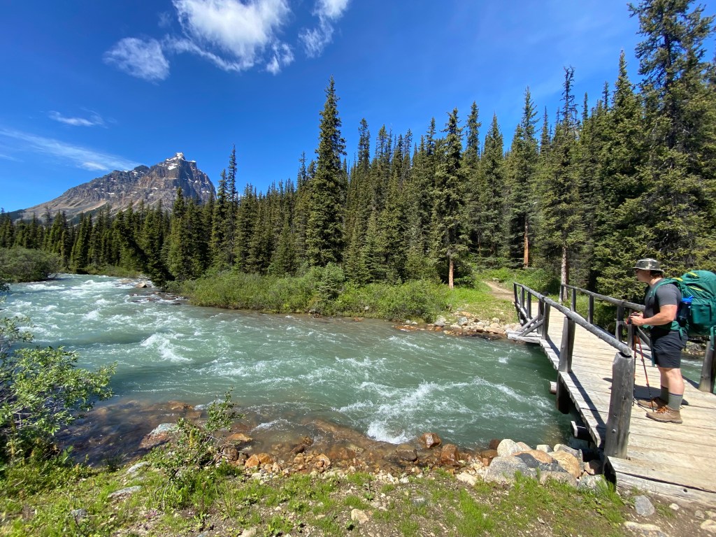
Our final day in the Tonquin Valley consisted of a 8km hike from Portal Creek camp to the trailhead. The first 4kms follow along the side of the mountains, as you slowly weave down towards the forest in the distance. This is certainly the better half of the hike out, as the trail is fully exposed offering 360 degree views (I can see this being a tough portion of the hike coming from the opposite direction, especially on a hot day).
Eventually the forest comes into full view as you enter into tree cover. We moved quickly down the rocky decline, but it still felt like forever (clearly I was ready to get to the car). Finally the trail veers right, crossing one last river, before emerging to the parking lot.
Despite ranting about how awful our first day of this trip was, I would definitely hike through the Tonquin Valley again one day…just not in July. My two takeaways are: 1) this trail would be absolutely stunning in the fall as the leaves change colour, and 2) 99% of the views are between Amethyst lake to Portal Creek trailhead. So basically, do not hike in July and if you just want to hike in and out from the same trailhead 9ie. no loop) definitely start from Portal Creek.
Must Knows:
Distance: 43.7km one way
Elevation: Amethyst to Portal: 1053m OR Portal to Amethyst: 1293m
Accessibility: 2WD accessible, relocation hike so 2 cars ideal or arrange alternate transportation
Water Availability: Plenty of streams along entire route + at every campsite
Food storage: Bear lockers provided at all sites
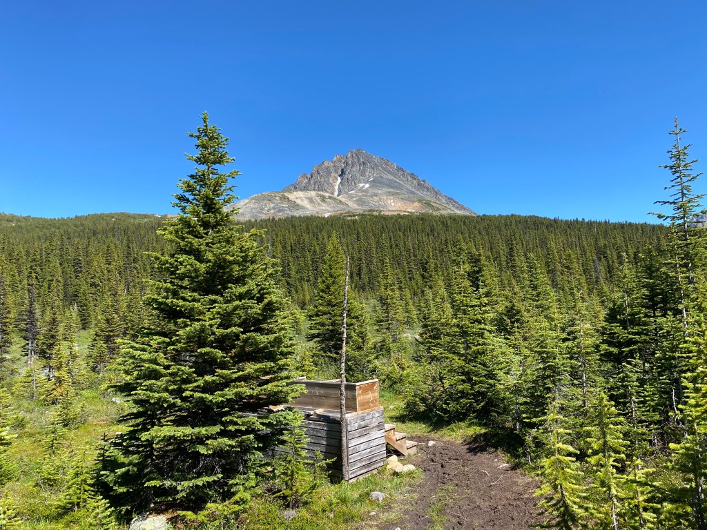
Facilities: Picnic Tables for cooking/eating, exposed pit toilets
Reservation Needed: Parks Canada Reservation for all sites
Note: You are in Grizzly territory, carry bear spray, make noise, and be aware!

Awesome Katie! Those mosquitos would have had me for breakfast, lunch and dinner! I’d have been one swollen blob. Stunning views!
LikeLiked by 1 person
They definitely did a number on us haha I counted at least 60 bites on my legs
LikeLike