With so many different mountains looking out over the Howe Sound it‘s a challenge to decide which one’s to hike first. While I definitely would love to summit all of them one day (and hopefully complete the Howe Sound Crest Trail which stretches from Cypress Provincial Park to Porteau Cove) I decided to start with a day hike up to The Lions.
There are two possible routes to take when hiking the Lions. The first option is to start from Cypress and follow the Howe Sound Crest Trail to St. Marks Summit and over Unnecessary Mountain (20km, 1450m). The alternative route is via the Lions (Binkert) Trail (15.5km, 1570m) which starts in the town of Lion’s Bay off of the Sea to Sky highway. From this trailhead there is also access to Brunswick Mountain and Tunnel Bluffs. We decided to take the Binkert trail route, however both options are fairly similar in distance and elevation.
Note: If you do choose the Binkert Trail, be cautious of the parking situation. The parking lot at the trailhead has very limited pay parking available, so many hikers will have to add about a 1km to their trip and park down the hill at Lion’s Bay Elementary School. Be cautious about street parking as most of it is reserved for residents and you risk a hefty fine and/or being towed.
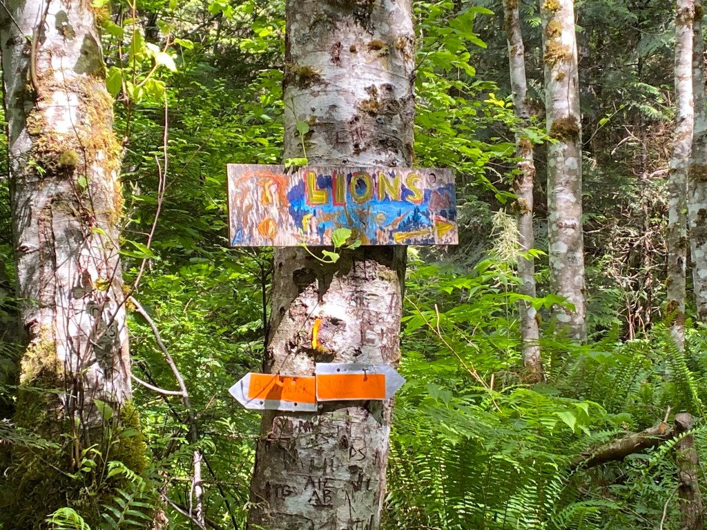
If you’re like most and have to park by the elementary school, your hike begins with a 1km walk up Bayview Road/Mountain Drive to the trailhead. This uphill walk serves as a great warm up for your legs, as the only level ground you will come across the entire hike is in the parking lot. From the trailhead the incline continues as you make your way along an old rocky logging road for about 2km until reaching a fork. In front of you will be a sign pointing left for Mount Brunswick or right for The Lions – it should go without saying that you’ll want to go right here.
The rocky path finally turns into trail as you head up into the trees. The key word here being “up”. With almost 1600m of elevation gain in under 9km, at times it definitely feels a bit more like a workout that just happens to have a view, than a hike.
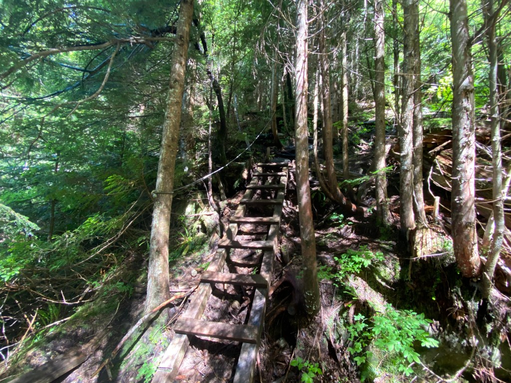
After about 4.5km the trail splits again, this time marked by a half burnt sign post. The path to the Lions veers right and takes you towards the final section of your ascent. From this point on the trail definitely gets a lot more technical and there are some sections where you will need to use your hands. While it is by no means a scramble, there is a small section of boulders to cross, as well as many large roots and fallen trees. I personally enjoyed this section the most because having to go slow and plan each move took my mind off of the steep elevation in front of me.
After what feels like forever, the trail finally opens up and you come out into a clearing overlooking a lush valley. From here you can catch a glimpse of the West Lion off in the distance. This may be a good place to stop and catch your breath for a moment before continuing the climb.
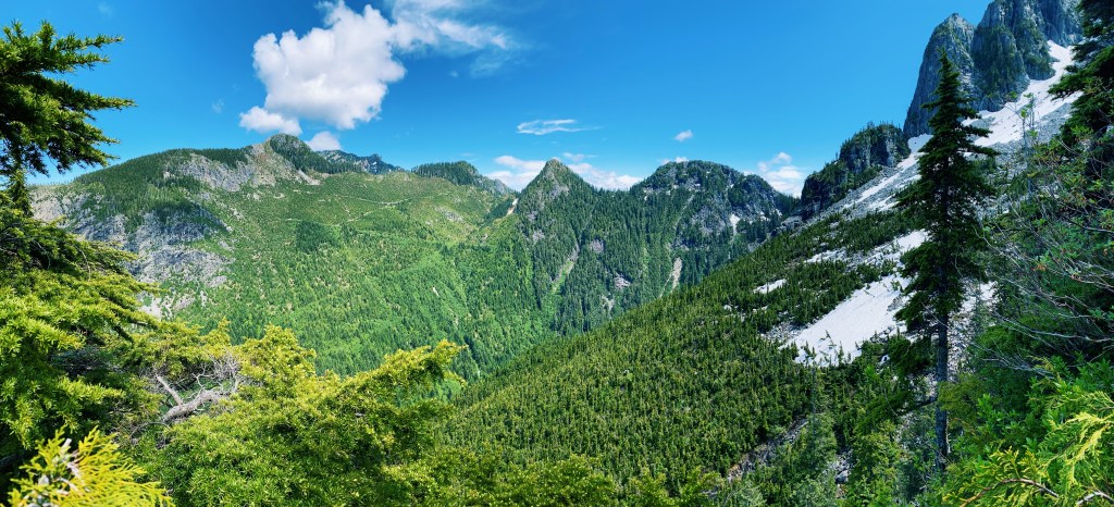
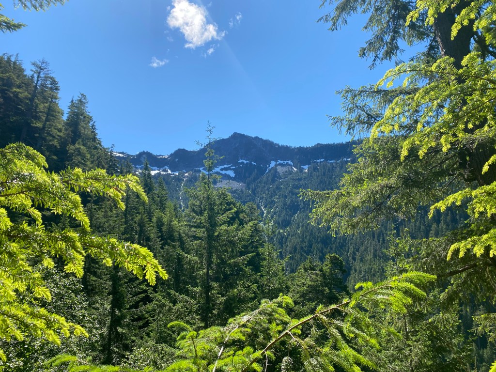
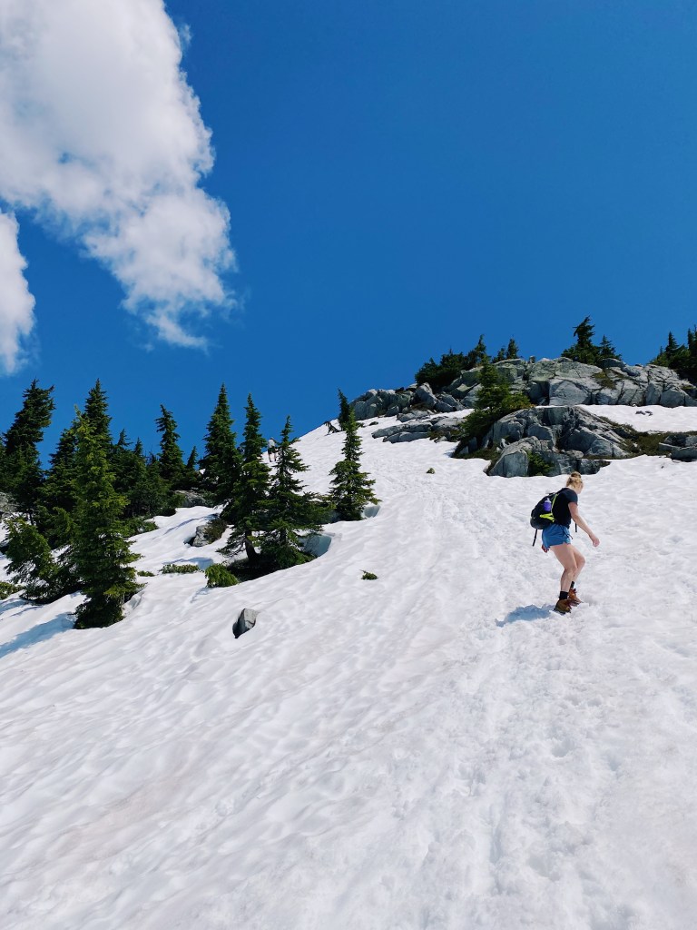
From this point onward the trail is fully exposed as you make your way up the mountainside. We completed this hike mid July and there was still a fair bit of snow from here on out. Crampons aren’t really necessary, but you’ll definitely want some shoes with good grip and a pair of sunglasses (the sun reflecting off of the snow was quite blinding and I always forget to pack mine).
While there are orange trail markers and spray painted rocks to help guide hikers up to the ridge-line, pay close attention as many of them may be covered in snow, depending on the time of year. A bit of moderate route finding was needed while traversing the snow and rock, however I’d imagine as the snow melts the path becomes a bit more clear. Either way, as long as you are going up, you’re headed in the right direction.
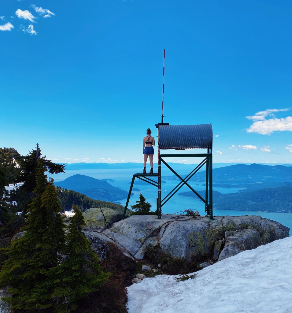
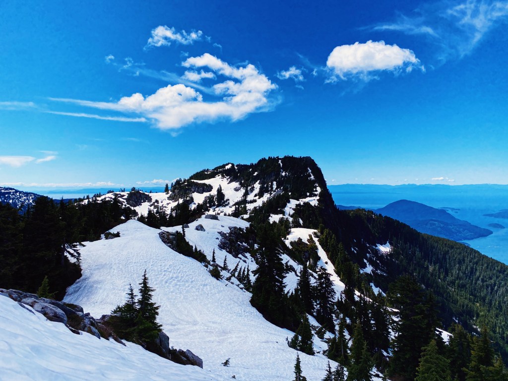
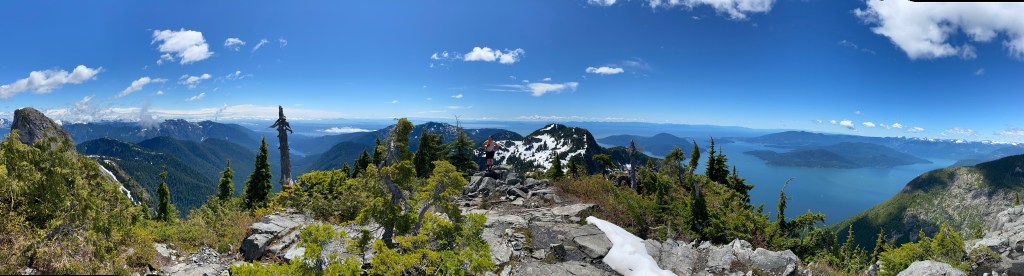
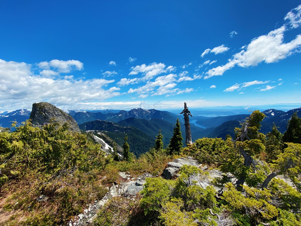
Finally, you will come up onto the top of the ridge where the Binkert trail meets up with the Howe Sound Crest trial. To the right stands Unnecessary mountain and to the left the Lions. While the view from here is nice, it only gets better as you head towards your destination. The climb is almost over and in about 400m you will reach the base of the West Lion.
Right: A view of Mount Unnecessary from the Lions
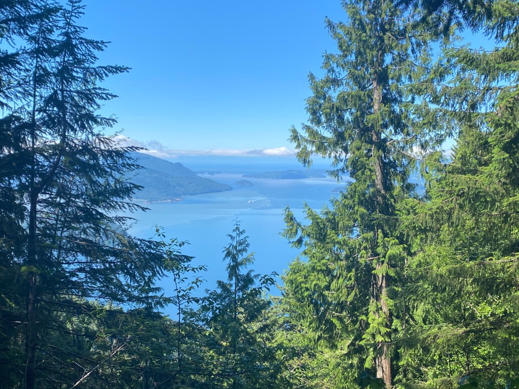
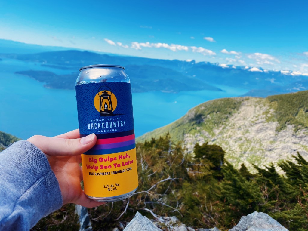
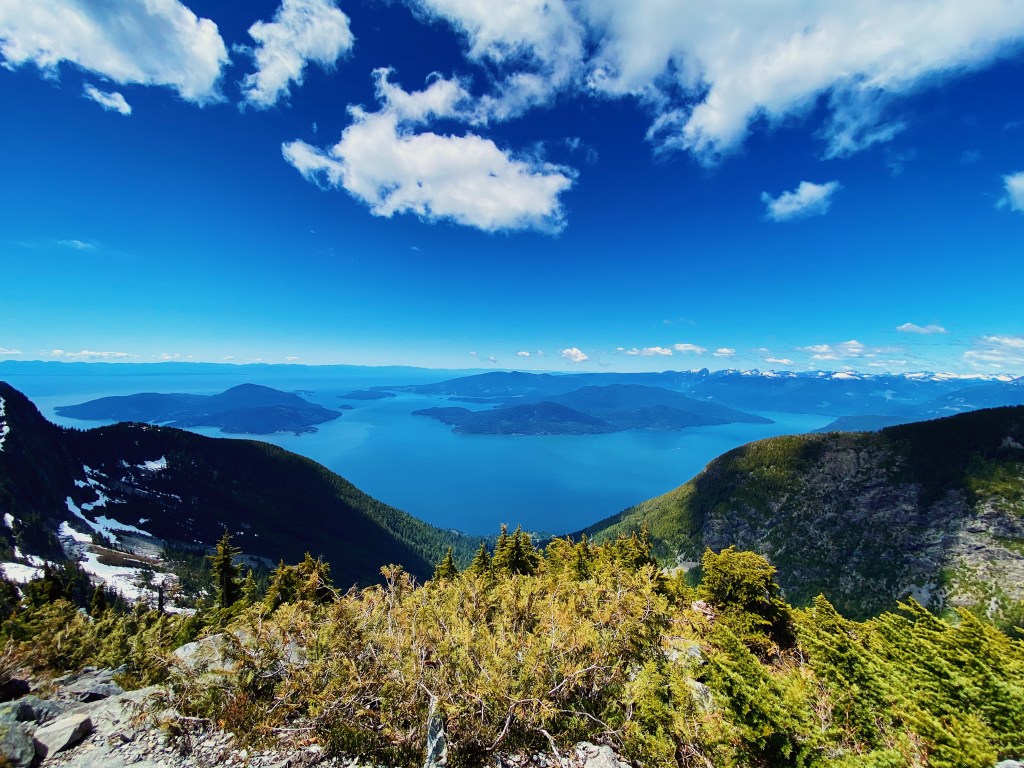
This is the perfect place to sit, soak in the sun, and enjoy some food (and a beer or two). The view from here is panoramic! Not only are you up close and personal with the majestic East and West Lions, a staple of the Vancouver skyline, but you are also overlooking the stunning Howe Sound. Not to mention there are mountains and lakes left, right and center. Needless to say it was pretty hard to pack up and leave when it came time to head back to the car.
While the East Lion lingers off in the distance and is inaccessible, those whom are feeling adventurous have the option to summit the West Lion. Having not done any prior research about the climb and hearing some mixed feedback from a few hikers who had attempted it, we decided against it. It is definitely something I plan on going back to do one day soon, as I do regret passing on the opportunity. However if you are not confident in your scrambling abilities I would advise avoiding it. The ascent is approximately 100m of elevation within 0.2km and there is very little room for error.
Right: Looking back on the East Lion and Capilano Lake in the distance
Instead, we spent about 45 minutes at the base of the West Lion relaxing and resting our legs. After chatting with a few other hikers and having a bite to eat we began our descent. The best part about the hike to the Lions being all uphill, is that now it’s all downhill from here! After a quick “ski” down the snow patches, accompanied by a couple of wipeouts, we made it back onto solid ground and it was smooth sailing from here.
While the terrain of this hike is not overly technical, the amount of elevation over a short distance definitely makes it a challenge. It took us approximately 5 1/5 hours at a moderate pace, however be prepared for a full day of hiking as it can take anywhere from 5-8 hours depending on fitness level. I’d also recommend bringing lots of water as the last portion of the hike is very exposed, making it tough on a hot summers day (trust me you’ll be sweating…a lot). We did run into a couple groups of hikers who never made it to the top, but as long as you come prepared it’s a manageable and extremely rewarding climb!
Must Knows:
Distance: 15.5km roundtrip (Elementary school to base of West Lion)
Elevation: 1575m
Accessibility: Highway driving (~5 minutes off of the Sea to Sky), transit accessible
Water Availability: Fair amount of stream crossings along first 5km, snow at summit
Facilities: Garbage can at trailhead, no washrooms at any point
Note: The Lions are part of the Howe Sound Crest Trail and thus camping is permitted at the top, however there are no washrooms or food storage. Also note while the above mentioned route does not require a day pass, if accessed via Cypress day the pass system is currently in effect due to Covid-19.

Wow, those mountain views are insane! I would love to go back to the beautiful British Columbia and explore more of its hiking trails. Hopefully we can start traveling again. It’s been a while since I’ve been anywhere due to the coronavirus! Thanks for sharing and fueling my wanderlust 😊 Aiva
LikeLiked by 1 person