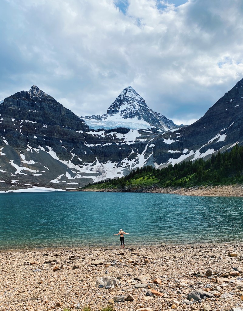
There’s a reason you’ll hear people refer to Mount Assiniboine as the “Matterhorn of the Rockies” or the “Canadian Swiss Alpes”. I spent five whole days in complete awe and am already planning my return trip.
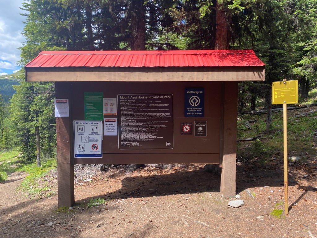
Mount Assiniboine Provincial Park is located just east of Kootenay National Park and south of Banff. While all of the access points into the park are through Alberta, it is a part of the British Columbia parks system. There are endless ways to explore this provincial park, so planning your itinerary can be pretty difficult, but don’t stress too much, it is a place you will definitely want to visit again!
There are two main ways to access Mount Assiniboine: either by helicopter or by hiking. A helicopter ride will cost you about $160 one way and takes approximately 8 minutes, flying from the Mount Shark helipad. This private helicopter company can also fly gear in and/or out on a hiker’s behalf for a fee.
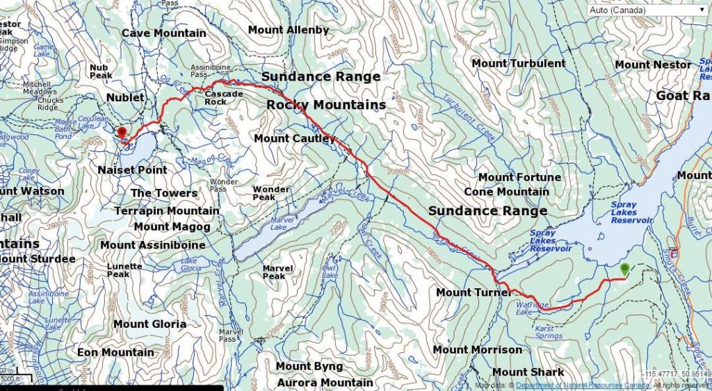
For those who choose to hike to Mount Assiniboine Provincial Park there are two different trailheads which will grant you access. Both of these routes are approximately 28km long and offer multiple campsites along the way, allowing you to break up the distance into two days if desired (these are booked through Parks Canada). The first route in is via Mount Shark (Bryant Creek) trailhead, which is located in Kananaskis Country. The other route is via Sunshine Ski Village near Banff National Park. Some people whom we met on our trip left one car at each trailhead in order to complete the journey as a through hike. If you don’t mind the extra driving, this would definitely be a great option, however we only had one car and so we decided to start and finish at the Mount Shark trailhead.
Day 1: Mount Shark to Marvel Lake (BR13) Campground
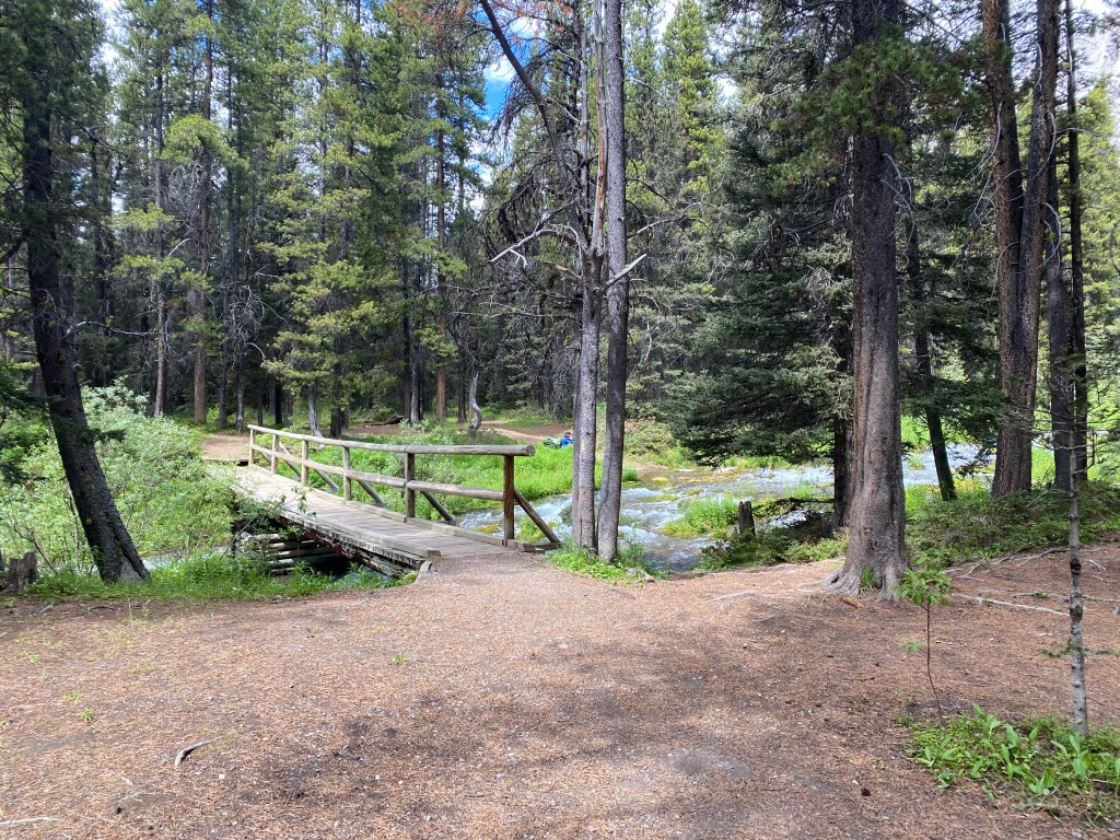
I decided to split the trek to Mount Assiniboine into two days. There are several different campsites which you can book through Parks Canada; at either 9km (Big Springs), 13km (Marvel Lake), 14km (McBride’s Camp) or 17km (Allenby Junction). Personally, I think that either Marvel Lake or McBride’s Camp are the best options as they are both at about the midway point of the hike. Neither of these camping sites are all to glamorous but they provide the basics you’ll need: a cooking area, bear lockers, pit toilets and a nearby water source.
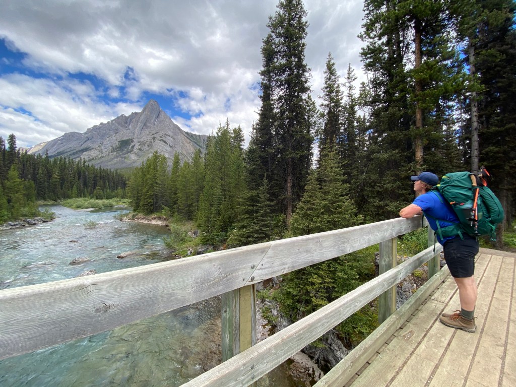
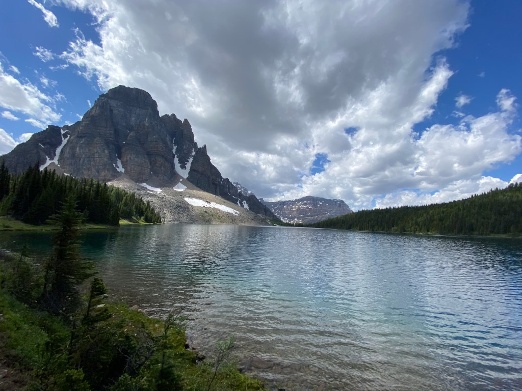
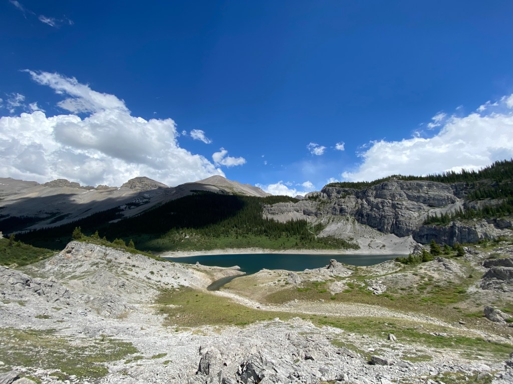
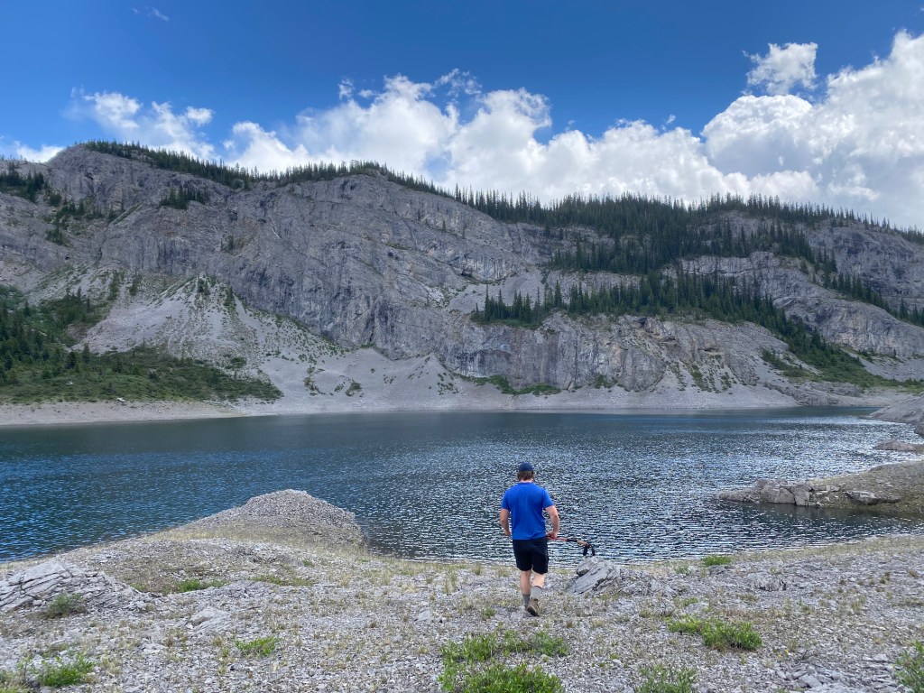
From Mount Shark parking lot to Marvel Lake, the elevation gain is fairly minimal. The first 6km of the hike takes you along a fairly flat gravel path used for cross country skiing in the winter, until you eventually reach the Bryant Creek Trail. From here the elevation picks up slightly and you will pass the Big Springs campsite. This is a great place to stop and enjoy some lunch while soaking in the views along the creek, before continuing on to your camp for the night. From Big Springs it is only another 4km until you reach the Marvel Lake junction, where we spent our first night.
Day 2: Marvel Lake to Mount Assiniboine via Assiniboine Pass
From Marvel Lake the trail to Mount Assiniboine splits, and you have the option of either taking Wonder or Assiniboine pass the rest of the way. Wonder Pass is the more picturesque of the two, however is consists of steep switchbacks and some extra elevation gain. Because of this we decided to take Assiniboine Pass on our way in and then hike out via Wonder Pass.
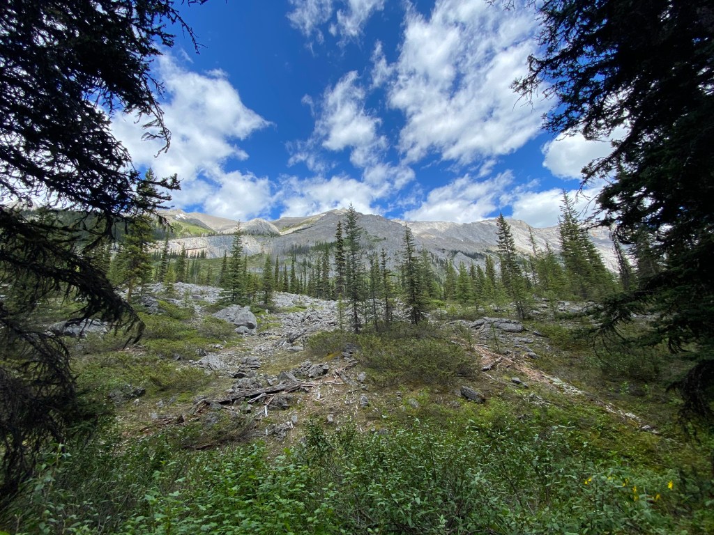
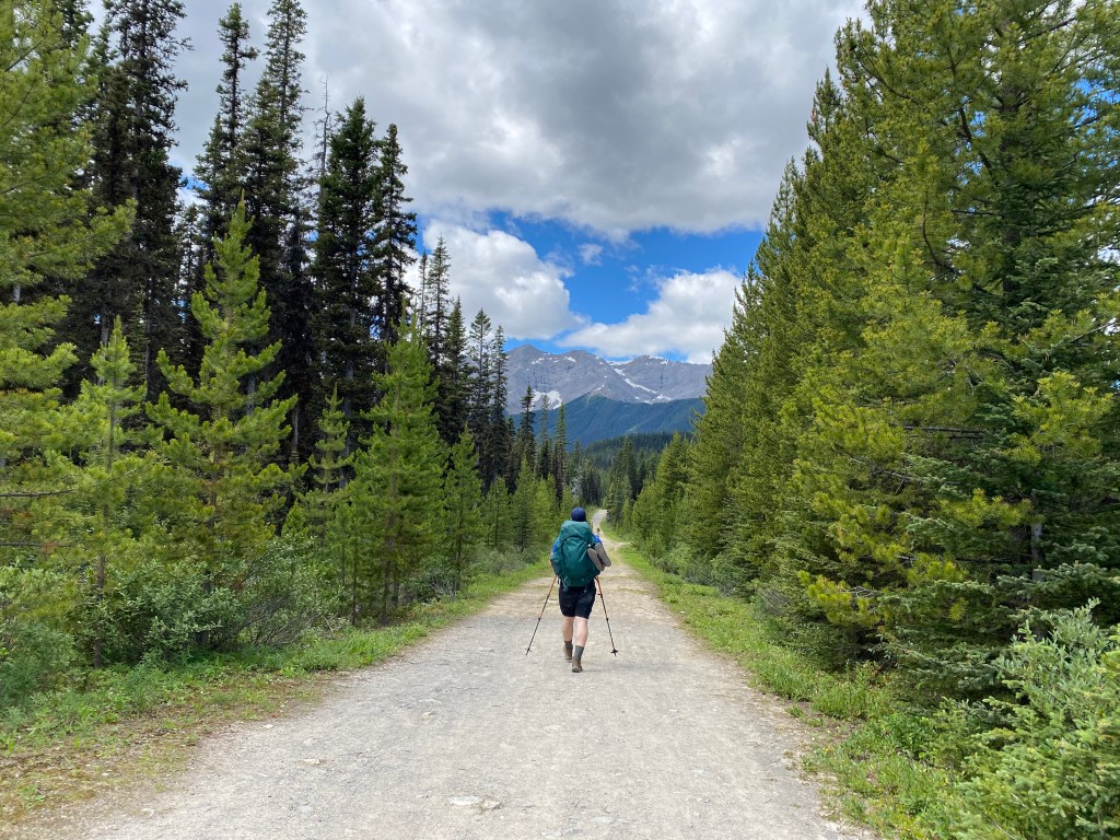
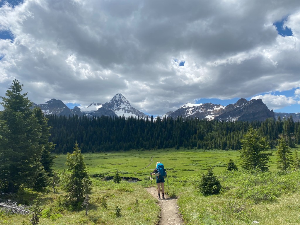
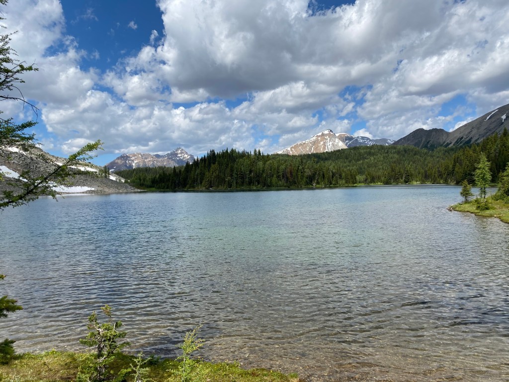
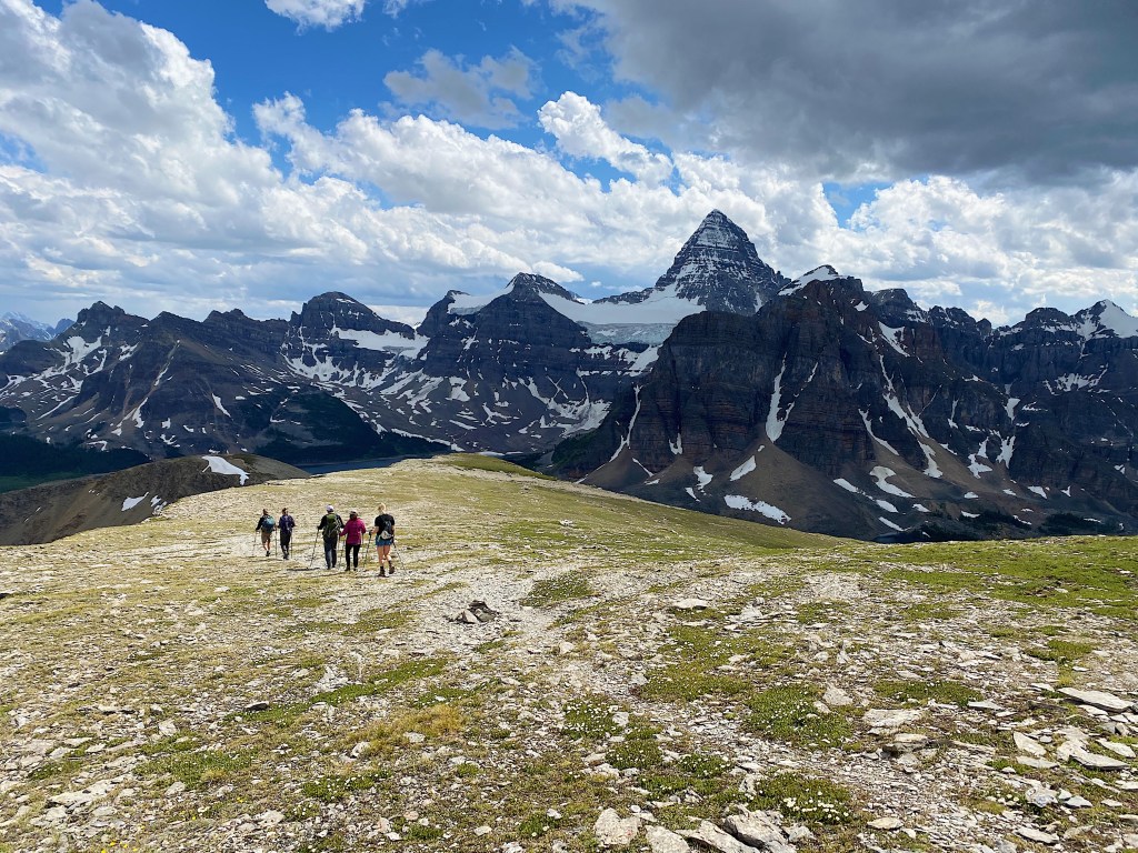
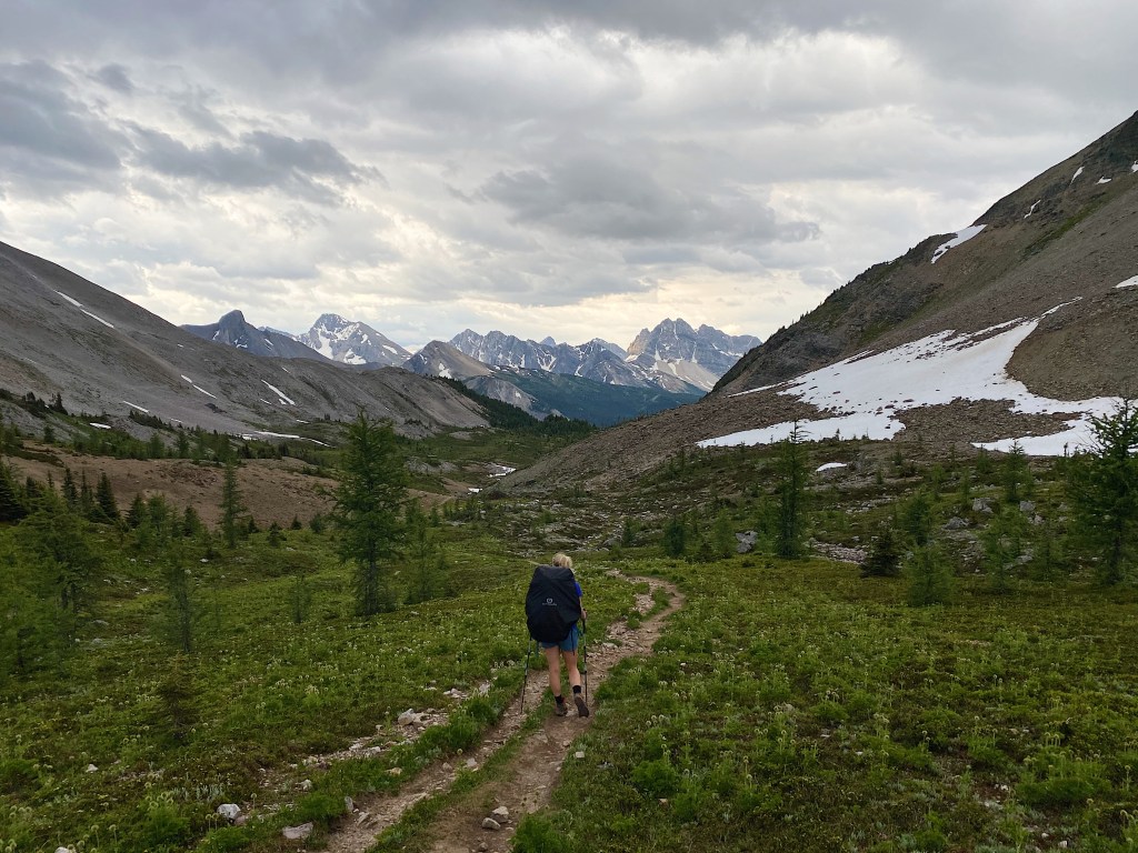
Though not as renowned as Wonder Pass, Assiniboine Pass still offers spectacular views of the surrounding landscape as you make your way through meadows and along rocky mountainsides. Approximately 13km and roughly 600m of elevation stand between you and apline paradise.
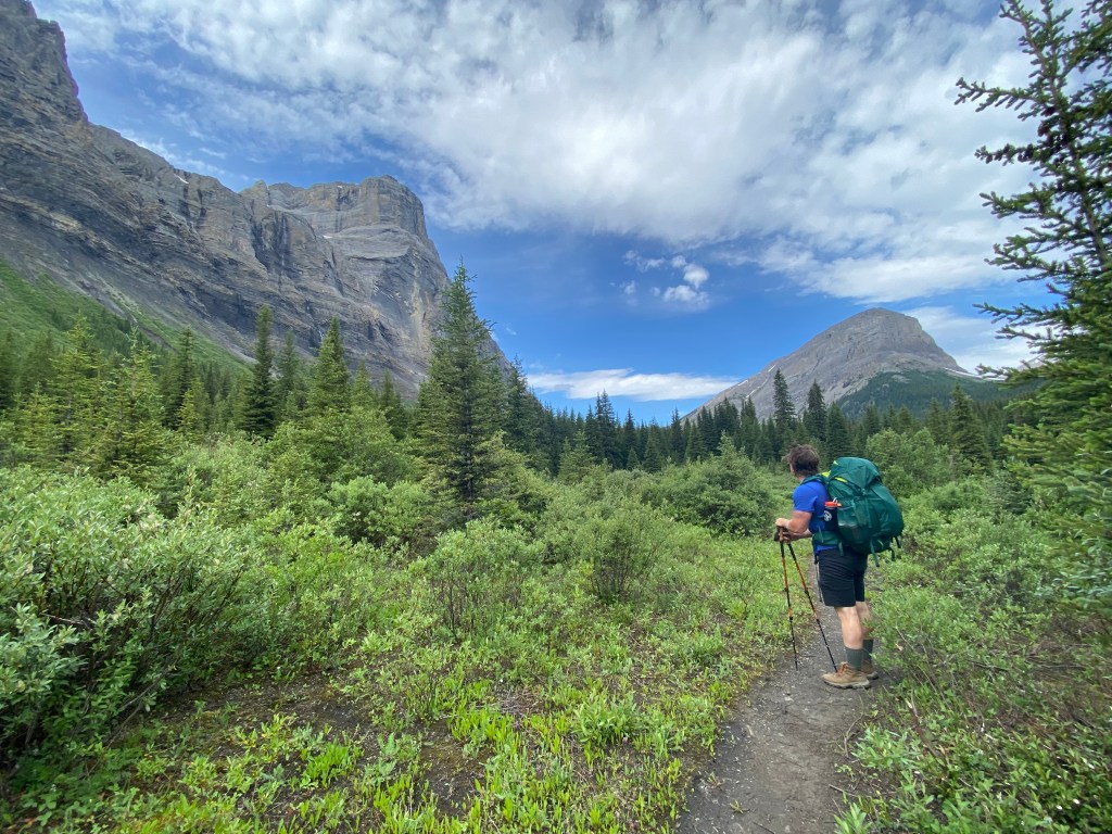
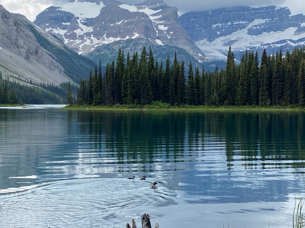
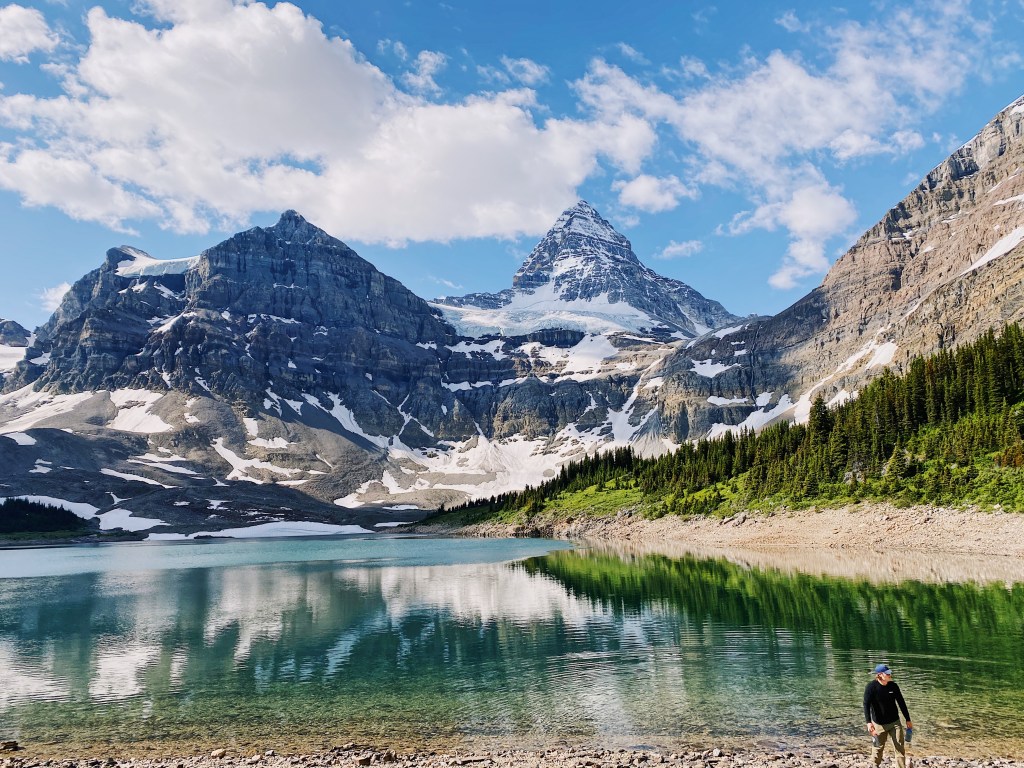
After around 3 hours of hiking you will reach the final stretch of incline which takes you up to the base of Mount Assiniboine Provincial Park. It is all smooth sailing from here, as the remaining 2km to Lake Magog consists mostly of downhill or flat ground. This is where you will also catch your first glimpse of Mount Assiniboine, towering over its neighbouring mountains.
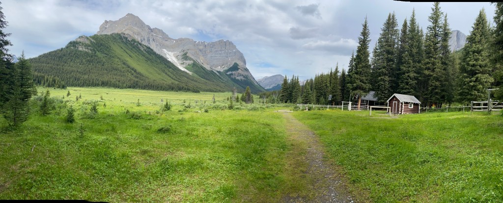
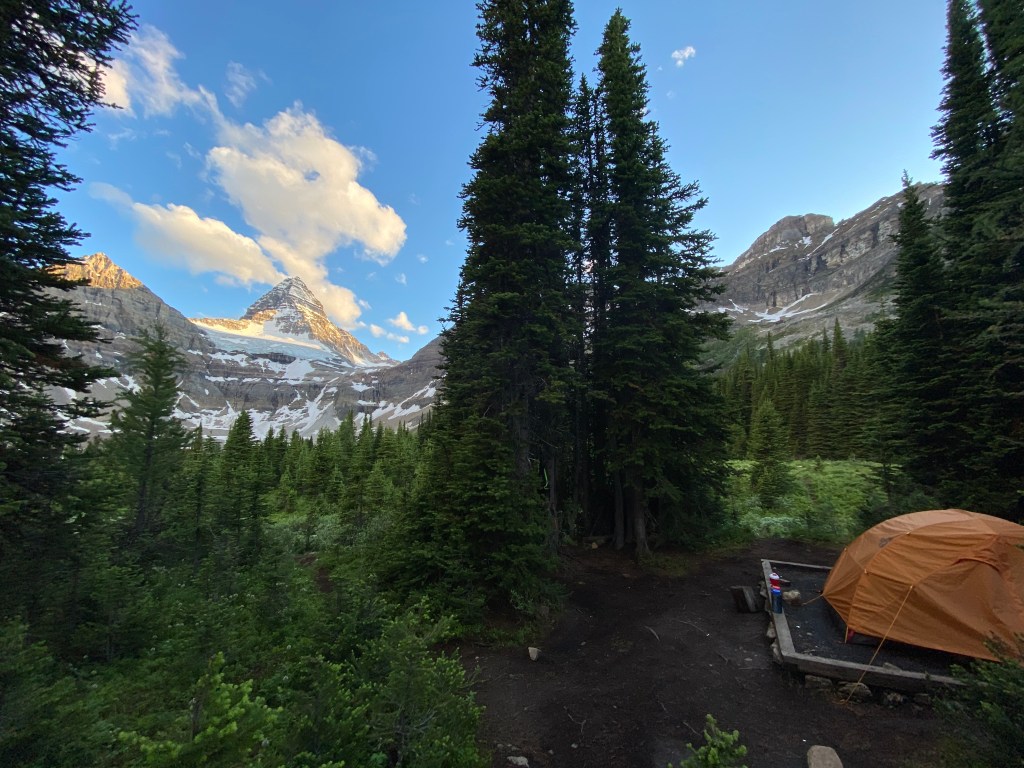
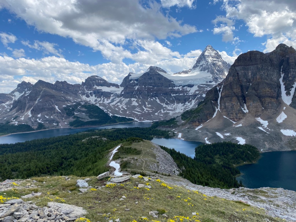
Once we arrived at Magog we selected our tent pad and set up camp. There are 36 total tent pads at Lake Magog and the first 5 will offer you the best view of Mount Assiniboine. At our campsite the mosquitoes were at swarming levels and so we spent most of our first day relaxing in the tent or down by the lake where the breeze kept the majority of them away.

Day 3: Lake Magog – Day hike to the Nub
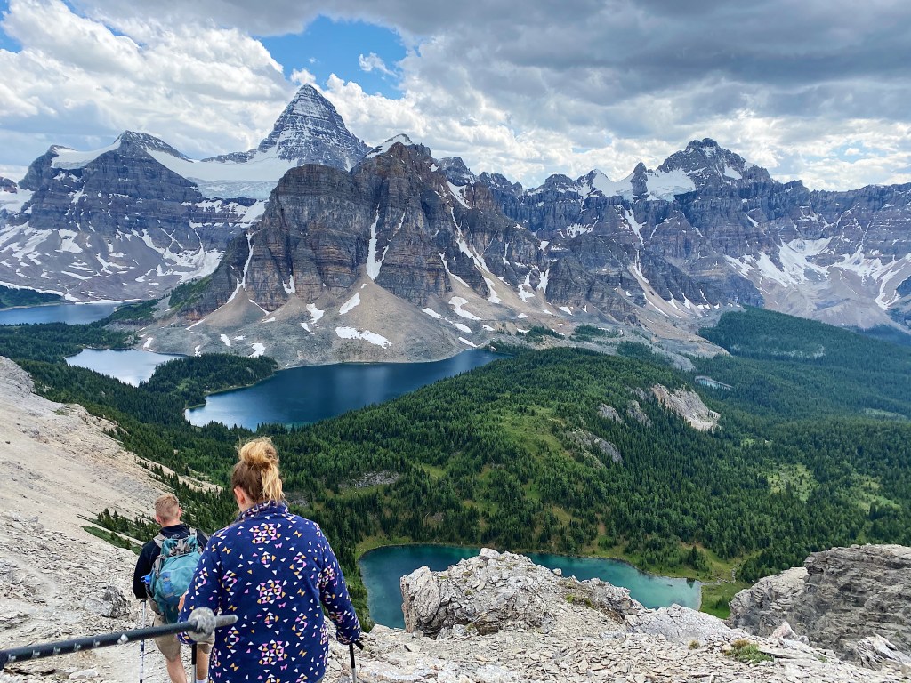
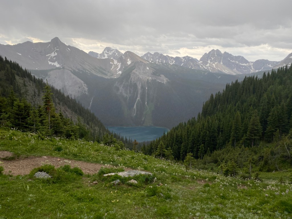
Lake Magog provides the perfect basecamp to access any of the numerous day hikes in the area. One of the most sought after day trips is to the Nub Peak. The hike is approximately 11.5km and 700m round trip, rewarding hikers with a spectacular 360 degree view at the top. While the main trail to Nub Peak will take you out and back along the same route, there is an unmarked marked trail which will can turn the trip into a loop. This route also allows you to check out Sunburst, Cerulean and Elizabeth Lakes along the way (saving you an extra day trip), as you start your ascend along the shore of Elizabeth Lake. The unmarked trail is available on Alltrails, but it does require some route finding and scrambling along steep terrain so use at your own risk!
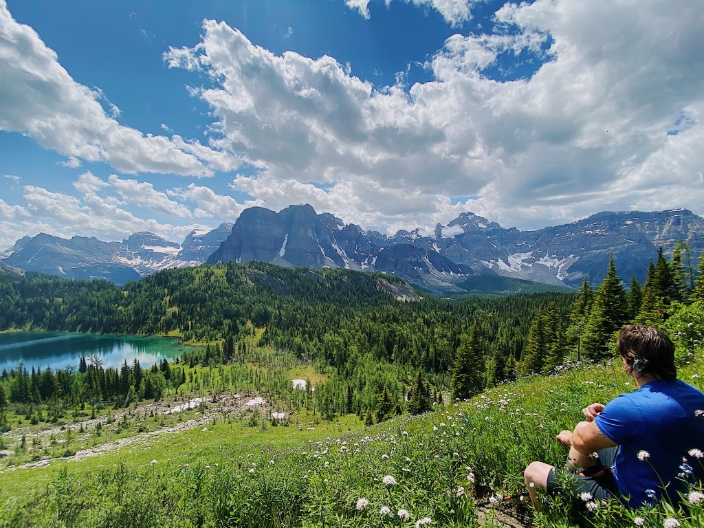
After stopping quite a few times to take in the incredible views (and catch our breath) we finally made it up the mountainside and onto the shale ridge leading to the nub. The majority of the climb is over now and it’s only about 1.5km more to the peak. Every step you take the views become more and more stunning. I don’t think I ever went more than 5 minutes without commenting on how beautiful something was.
Once you reach the summit this the perfect place to sit and relax for a while. It can get pretty breezy up there, so make sure you pack a sweater along with your lunch! At the summit we met a wonderful group of people from Calgary and spent the next hour or so joking and enjoying the mosquito free bliss (did I mention the mosquitoes were abundant on this trip?). After lunch we headed back down to camp for some dinner along the lake shore and some more relaxation.
Day 4: Lake Magog – Day hike to Lake Og
On our last full day we decided to take a day trip out to Lake Og. If you hike in via the Sunshine Village trailhead you will pass this lake on your way to Magog. It is about a 10km roundtrip with virtually no elevation from Magog, making it a quick and easy day trip if you’re looking for something to do. Unfortunately for us, this is where our luck had finally run out in regards to the weather. The forecast called for scattered showers throughout the day, which would have been fine as we don’t mind getting a little wet on our hikes. However, that rain quickly turned into a hail storm which was unideal to say the least.
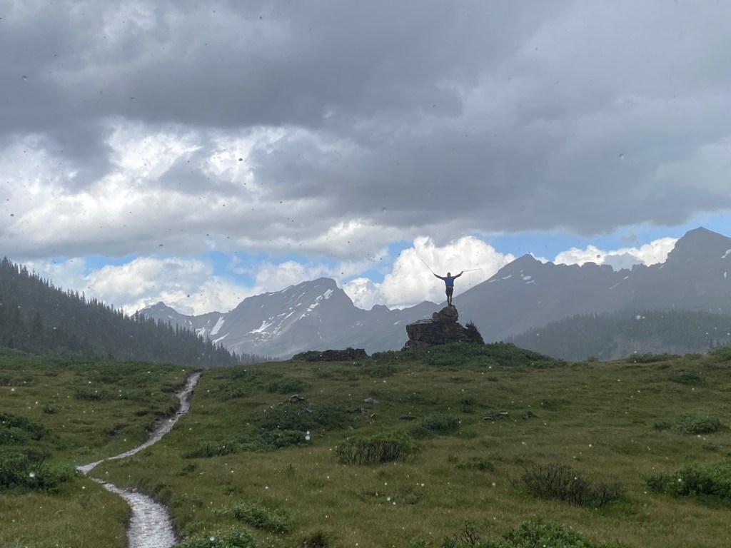
We persevered through the hail and by the time we reached Lake Og the skies were clear and we were once again dry. Lake Og also offers a campsite for hikers, although it is not quite as large or as nice as the one at Lake Magog. After enjoying about 30 minutes of sunshine at the lake, the weather began to change again. Before we knew it we were hiking back through torrential hail and boot deep water. I’d heard that the weather in the Rockies can change quickly, but nothing can really prepare you for what that actually looks like! Within a span of about 30 minuets we experienced sunshine, rain, hail and thunder. Thankfully, by the time we returned to camp the sky was once again clear and within a matter of hours all of our gear was dry.
Day 5: Lake Magog to Mount Shark via Wonder Pass
After spending three incredible nights at Lake Magog it was time to return to civilization. We reluctantly woke up at 5am to get an early start on the long day ahead. I had decided we would complete the hike out in one day and so in front of us lay 28km of trail (thankfully most of it was downhill). We followed the winding path away from Lake Magog and towards Wonder Pass as the sun rose in the distance.
From the lake it’s a short and steady climb until you reach the beginning of Wonder Pass, which if you’re curious, lives up to it’s name. As you come up over the top of the pass you are greeted by overlapping mountains as far as the eye can see. Even on a rainy morning it was breathtaking.
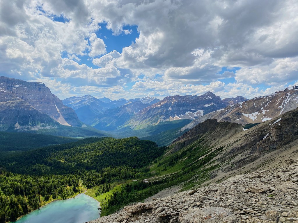
Wonder Pass also marks the boundary of Mount Assiniboine Provincial Park, and from here you are back in National Parks territory. Enjoy a slow descent through the valley until you reach a stretch of steep switchbacks which will take you down to a mountain ridge overlooking Marvel lake. The trail follows along the lake shoreline from above until you eventually wind up back in the forest. With the exception of an optional detour to the shore of Marvel, the rest of the hike out is fairly anticlimactic. After travelling 15 kilometers in 3 hours and running into one bold Cariboo, the rest of the hike out was a big blur to be honest. Our mantra was the classic “one foot in front of the other” for the remaining 13km.
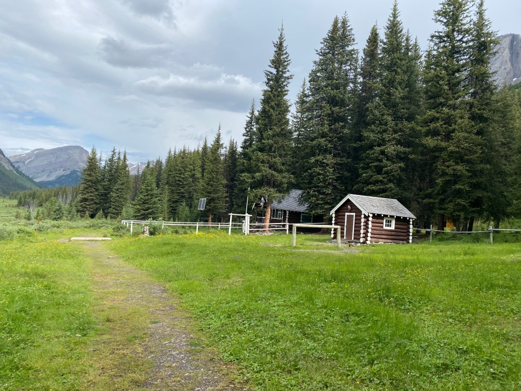
While we spent all three nights at Lake Magog camping, anybody visiting the park has the option to stay at the Naiset Huts or the Hind Hut, operated through the Assiniboine Lodge. The fee for the huts is currently $20/night and they are operated by the lodge (this is owned by a private company but you can find more information on the BC Parks website). The Assiniboine Lodge also hosts a happy hour/tea time daily, but unfortunately for us it is closed this year due to Covid (another reason to go back one day!). While there are so many different options to consider when planning your trip to Mount Assiniboine one thing I can guarantee for sure is that you will not be disappointed!
Must Knows:
Distance: ~28km one way from either trailhead to Lake Magog
Elevation: ~1000-1200m depending on starting point
Accessibility: 2WD accessible along a maintained gravel road (to Mt. Shark parking), no transit
Water Availability: Lots of stream crossings up to BR13/14, make sure to fill up here as there are not many more sources until you reach Lake Magog.
Food storage: Bear lockers provided at all sites
Facilities: Cooking station, unfiltered water available at all cooking stations, grey water drain, outhouse pit toilets (very clean compare to most backcountry washrooms)
Reservation Needed: BC Parks reservation for Mount Assiniboine + Parks Canada Reservation for other sites along trail in/out
Note: You are in prime Grizzly territory, carry bear spray, make noise, and be aware!

Looks amazing, every photo is like a postcard – my favourite is the mountains’ reflection in the water.
LikeLike
Thank you! Definitely one of the most scenic hikes I have done.
LikeLiked by 1 person